the map
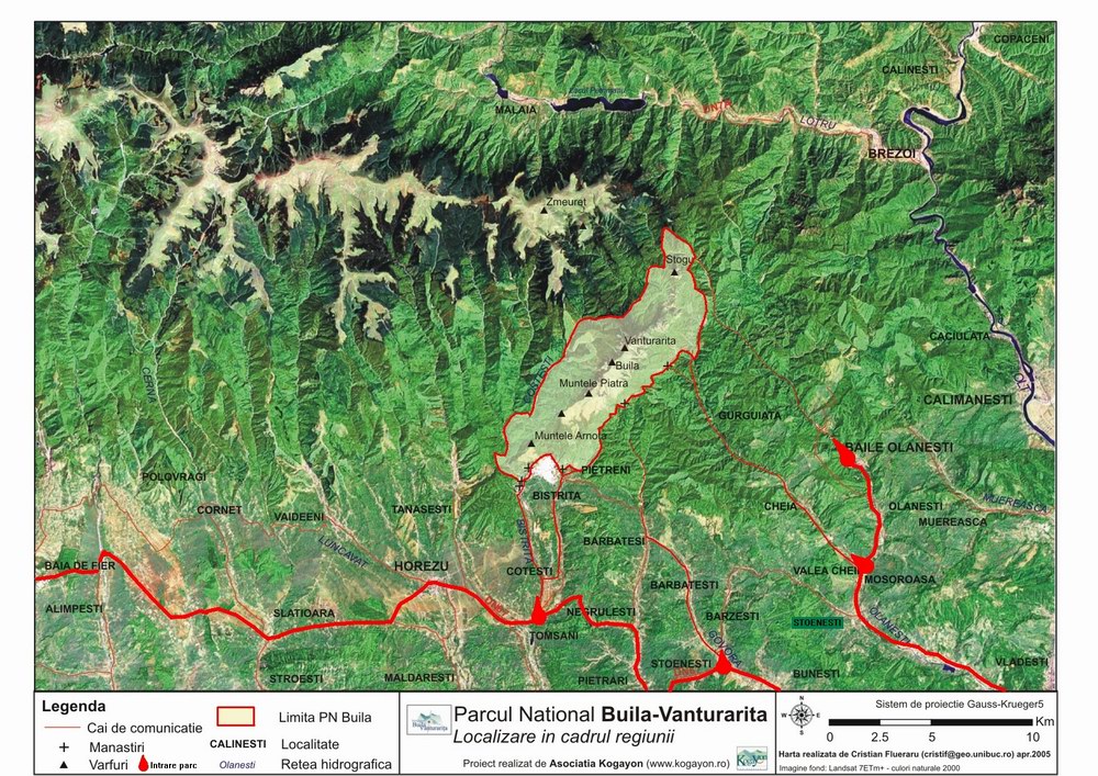
The Buila-Vânturariţa massif is located in the central-northern part of Vâlcea county and is part of the Căpățănii Mountains. The massif stands out from their main chain, both by layout and by constitution and relief. The main ridge of the Căpățănii Mountains, consisting mainly of crystalline schists, has an east-west layout, with secondary ridges to the north and south. The exception is two calcareous massifs, whose main ridges are arranged in the SW-NE direction: the Târnovu massif in the northwest and the Buila-Vânturariţa massif in the southeast.
The Buila-Vânturariţa massif stretches from the west of the Bistriţa gorges to the east of the Olăneştilor gorges (Folea). The connection with the Căpățănii Mountains is made through Plaiul Netedu (the interfluve between the Bistriţa and Costeşti rivers), the Lespezi plain (the interfluve between the Costeşti and Cheia rivers) and the Hădărău plain (the interfluve between the Cheia rivers and Olăneşti).
The Buila-Vânturariţa ridge has a linear spatial extension, with a length of about 14 km and a width between 0.5 and 2.5 m km (extension of the Jurassic limestones). The absolute altitude is at the top of Vânturariţa Mare (1885 m), and the minimum at the exit of Bistriţa from Chei (550 m).
The main peaks of the massif are, from southwest to northeast, the following: Arnota (1183.7 m), Cacova Mountain (1525.1 m), Piatra Mountain (1643 m), Albu Mountain (1658.9 m), Buila (1848.6 m), Ştevioara (1847 m), Vânturariţa Mare (1885.2 m), Vioreanu (1866 m), Vânturariţa Mică (1655 m), Stogu (981 m).